Esta isla del archipiélago de las Australes, está situada en 27° 35′ S y 144° 20′ W.
Es un antiguo volcán de 650 m., la parte central se hundió formando una caldera de murallas escarpadas. Al este, se abre al océano que inunda el fondo de la caldera formando una bahía, Haurei.
Ubicada a 3.440 km. al oeste de Rapa Nui, tiene un clima templado y húmedo.
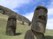
“En la época del descubrimiento por el navegante Georges Vancouver (1791), los 1500 a 2000 habitantes, según una estimación, se distribuían en 14 clanes a menudo en guerra. Los numerosos vestigios de “pare” (pueblos consolidados) dan prueba de esta inseguridad. Los de Morongo Uta, Tevaitau, Tanga, Ororangi, Pukutake, Pukumanga, Kapitanga y Vairu generalmente fueron construidos a la intersección del pico principal y de los picos secundarios. El conjunto requirió grandes trabajos de ordenación: nivelaciones y construcción de paredes de sostenimiento en piedras secas. Zanjas venían a reforzar el carácter defensivo de tales lugares. Las terrazas de vivienda implicaban silos en fosas para las reservas de taro (tio’o taro).
La gente de Rapa utilizaba piraguas cosidas manejadas con palas puntiagudas. Algunas piraguas dobles, con velas, podían transportar a 40 guerreros.
Según William Ellis, el principal ídolo de los habitantes de Rapa “se llamaba a Paparua, estaba hecho con la vaina de nuez de coco curiosamente trenzada en una especie de forma cilíndrica, plena en el centro y más pequeña hacia las extremidades y no tenía más de tres pulgadas de longitud.” Invocaban a este Dios para las victorias durante la guerra, para la curación de las enfermedades y para que les ayude a obtener una gran cantidad de tortugas”.

Este mapa muestra la topografía de Rapa Iti.
La mayor parte del territorio está compuesto por escarpadas montañas y solo pequeñas franjas de terreno permiten el cultivo a orillas de la Bahía Ahurei. En los mapas actuales es denominada Haurei.
“…había algo curioso en las cumbres más altas, que parecían pirámides de Méjico cubiertas de vegetación o fortificaciones incaicas escalonadas como las que se alzan en las salvajes montañas del Perú. Desde luego, allí había algo digno de investigarse.” (Heyerdahl 1975, p. 336).
“Por fin habíamos conseguido trepar hasta la más alta cresta de la cadena montañosa, después de escalar vertiginosos barrancos y repechos.
– Esto es Morongo Uta – murmuró el indígena que nos había indicado el camino.
– ¿Quién lo construyó?
Él se encogió de hombros.
– Tal vez un rey. ¡Quien sabe!
…empezamos a recorrer aquellas ruinas y escudriñar lo que ocultaba la densa vegetación” (Heyerdahl)
Heyerdahl describe una isla de laderas escarpadas, altas montañas en sus cumbres se encuentran grandes construcciones cuyos constructores se desconocen.
“Pero Morongo Uta no era un palacio. Tampoco era un castillo. Cualquiera que subiese a las montañas, podía ver que no se trataba de una sola edificación, sino de las ruinas abandonadas de todo un poblado. Se habían equivocado quienes lo consideraban una obra de fortificación. Tampoco eran terrazas de cultivo. La verdad era que allí, en las mas altas cumbres de Rapa Iti, la población entera de la isla tuvo en otros tiempos su morada permanente” (Heyerdahl, 1975, p. 347).
“Los antiguos fogones permanecían intactos, llenos de carbón vegetal y cenizas. Eran curiosos hornos de piedra de un tipo hasta entonces desconocido en toda la Polinesia, a excepción de la Isla de Pascua” (Heyerdahl, 1975, p. 347).
No se trataba de terrazas de cultivo y los hornos mostraban semejanza con los que él había visto hace solo unos días en Rapa Nui.
En la isla, las áreas de cultivo son franjas de terreno ubicado a orillas de la bahía. Por lo tanto no podían ocupar estas para vivir. Al ser escasa la tierra de cultivo resulta lógico pensar en la necesidad de construir en altura, pero en Rapa Iti esto solo era posible en las cumbres, pues las laderas escarpadas lo hacían imposible.
Como en el caso de Rapa Nui una población creciente pudo llevar a guerras internas y quizás también existieron invasiones externas. Pero esas no parecían ser las preocupaciones principales si Morongo Uta y otras construcciones no fueron concebidas como fortalezas. Si no se trataba de fortificaciones quizás no era de humanos sino de otra cosa que escapaban sus habitantes.
Según Douglas et al, (2007) “Nuevas excavaciones e inspecciones en la isla de Rapa han mostrado que un refugio rocoso fue ocupado por colonizadores tempranos alrededor del 1200 DC y los primeros fuertes de la colina fueron erigidos cerca de 300 años más tarde.
La fortificación ocurrió hasta el período del contacto y proliferó alrededor del 1700 DC. El cultivo del taro en chacras y en terrazas llevó el mismo paso que la construcción de fuertes. Los autores hacen una conexión entre fuerte-edificio y hacer chacra-campos, demostrando que la presión en recursos provocó la intensificación de la agricultura y la hostilidad entre las comunidades de la Isla Pequeña”…
…La competencia por recursos ante la expansión demográfica y la degradación ambiental es uno de varias fuerzas que impulsan el desarrollo de la complejidad social y política y tuvieron un papel claramente en el surgimiento de jefaturas en las islas del Pacífico (Kirch 1984).
Las aldeas fortificadas en las cumbres en Polinesia Oriental proporcionan la evidencia arqueológica más obvia de la competencia y la guerra antes del contacto europeo e indican que ese conflicto entre aldeas fue un componente importante de la vida social y política (Mejor 1993, Burley 1998, Sortee 2004, Verde 1967, Kirch 1984).
La naturaleza hiper-fortificada de Rapa, a menudo es utilizada como un ejemplo de hostilidades
inter-aldeas de polinesia (Kirch 1984).
Douglas encuentra en un alero rocoso, evidencias de ocupación de la Isla alrededor del 1200 (± 20), fecha en la que fue ocupada por primera vez Rapa Nui. Es necesario recordar que no necesariamente encontró todo el material existente en la isla correspondiente a esa fecha. En todo caso esta fecha es confirmada con otra técnica “La estratigrafía de polen que puede ser separada en tres fases”. Una fase costera pre-humano del bosque (280-165 cm, 2000a.C al 1200d.C), una fase agrícola polinesia (165-60cm, 1200 d.C a 1825d.C) y una fase post-europeo del contacto (encima de 60 cm, 1825d.C al presente)”. A continuación, el mapa de Rapa, muestra los sitios señalados por Douglas.
Según estos autores “Restos de muros de piedra seca con características de terraza cubren muchos de los fondos de los valles aluviales de la isla y son indicio de la extensión anterior de Colocasia Esculenta, Malanga, Taro, ocasionalmente llamada Oreja de Elefante”. Las áreas de cultivo estaban en los valles, parte baja de la Isla.
“De tradiciones orales y otras fuentes, surgió que Colocasia Esculenta fue el alimento básico del tiempo de la ocupación inicial. Los numerosos muros de piedra, indican que el nivel de producción de bulbo, era similar al de los mejores sistemas de producción conocidos en el Pacifico, las islas hawaianas y Nueva Caledonia. Algunos de los valles son utilizados todavía para el cultivo, pero representan sólo una pequeña proporción de la tierra cultivable total disponible. Muchos de los sistemas abandonados o improductivos de terraza han sido anegados y ahora están cubiertos por cultivos agrícolas introducidos”.
La gran área de producción agrícola de taro en la base de los valles, hoy está ocupada por otros cultivos.
En las conclusiones los autores señalan que “Nuestra investigación en Rapa ha llegado a resultados similares de otras investigaciones a través de Polinesia Oriental, especialmente en las islas más aisladas como Hawaii, Isla de Pascua y Nueva Zelanda.
Estos consisten en: una sucesión cronológica que indica una colonización relativamente tardía, después del 1000d. C. La expansión demográfica, el cambio ambiental, plausiblemente antropogénica como fuente principal, que empieza temprano en la secuencia de ocupación y que implica la modificación substancial del ambiente, inclusive el establecimiento de sistemas agrícola extensos”.
Esta explosión agrícola y la subsecuente degradación ambiental pudo ser en parte la causa de luchas entre los diversos poblados algo similar a lo relatado en las leyendas que indican que Hotu Matu´a y su gente deben emigrar luego de una guerra, pero también debido al hundimiento de su isla Rapa Iti.
La información que se recogió hace casi un siglo, explicaba como se había poblado la isla. Según esta leyenda, los primeros habitantes fueron mujeres procedentes de la Isla de Pascua, que habían cruzado el océano en sus primitivas embarcaciones. Muchas de ellas iban a ser madres. Ellas y los hijos que dieron a luz, iniciaron la población de Rapa Iti.
Esta leyenda habla de antiguos viajes entre ambas islas. Y a no ser que alguna de estas mujeres fuera navegante experimentada, que no figura en las leyendas ni relatos, el viaje no lo debía requerir. Y se lograba posiblemente, aprovechando vientos y corrientes favorables.
Lamentablemente las leyendas no permiten situarse en una fecha precisa, tampoco señala si estas mujeres fueron las primeras en descubrir esta isla. Esto sería extraño pues Rapa Iti está más cerca de Tahiti y sus pobladas islas, que de Rapa Nui.

TIPOS DE SITIOS POR COLOR
Verde NUCLEO
Rojo FORTIFICACIÓN
Azul REFUGIO ROCOSO
Mapa de Rapa
01= Akatanuir
02= Ananua
03= Angairao
04= Taga
05= Marango Uta
06= Potaketale
07= Tanga
08= Tevaitau
09= Ororangir
10= Vairu
11= Rutara
13= Mogurape
12= Kapitanga
14= Pukitaletale
15= Turku Core 2
Genética:
La filiación genética del pueblo Rapa Nui con los pueblos polinesios, está demostrada en Belwood
(1989-1995) citado en Hagelberg et al (1999).